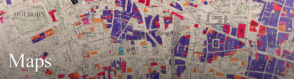
Skip to Content
Log In
    HomeAdvanced SearchSearch TipsGalleriesCollectionsMapsLondon Picture MapAbout the London Picture ArchiveHelp and Support

    Popular Searches

    • Cafes
    • Christmas
    • Coffee Houses
    • Crystal Palace - Hyde Park
    • Crystal Palace - Sydenham
    • Grinling Gibbons
    • Gunpowder Plot (1605)
    • Horwood's Map of London
    • Leicester Square
    • Livery Companies
    • London Fire Brigade
    • London Pub Photographs
    • Lord Mayor of London
    • May Day
    • Piccadilly Circus
    • Queen Elizabeth II
    • Rossetti La Ghirlandata
    • Second World War Bomb Damage
    • ship
    • The Crystal Palace Fire
    • Trafalgar Square
    • Victorian Schools
    • Victorian Whitechapel
    • Wembley Stadium
    • Workhouses

    Galleries

    • 1920s London
    • Inns, Taverns and Public Houses
    • London Horsepower
    • London's Department Stores
    • London's Key Workers
    • The National Health Service
    • Tube, Tram, Bus
    • Evacustes Phipson
    • LCC Bomb Damage Maps
    • LCC Tramways
    • London's East End
    • London's Museums
    • Monet's London
    • Policing London
    • Women and Art in London
    • More galleries

    Institutions

    • The London Archives
    • Guildhall Art Gallery
    Maps

    The historical map collections at The London Archives provide an absorbing way to experience the development of the city, from the late sixteenth century to the present day. From the first attempts to chart the streets of the City of London to the record of Second World War devastation created in the London County Council Bomb Damage maps, they provide a unique view of London’s story and many of the events that shaped the city we know today.

    The maps collected here bring together some of the best-known records of the capital, including work by Georg Braun and Frans Hogenberg, John Rocque, John Ogilby and William Morgan, Richard Horwood, and Christopher and John Greenwood. Early visitor guides feature alongside, tram routes, Goad’s Insurance Plan, local plans and thematic surveys, including Charles Booth's map of London poverty. This collection can be used to study the growth of London at a local level, with maps of parishes and localities, as well as the development of London across the Greater London area.

    This page provides access to all the maps available on the London Picture Archive. They are sorted below by date, showing the earliest works first, but you can also sort them by title. If you want to limit the maps to a particular date or only want to see maps created by a particular publisher, you can use the refine options. While there are a lot of maps to enjoy here, please note it is not yet a full set of copies of the maps of the capital available to view at The London Archives.

    Maps

    of 81
    Refine
    Sort
    32629
    Bartholomew plan of central London
    242709
    Hastings: Tilekiln Farm plan.
    242708
    Hastings: Tilekiln Farm plan.
    242647
    Hastings: Tilekiln Farm plan.
    32686
    Camberwell map
    346484
    GLC Urban Motorway Plan
    239749
    Area map of Poplar, Stepney and Bow and Bromley.
    346481
    County of London Plan - Development and Zoning Plan
    346480
    County of London Plan - The Banks of the Thames
    346479
    County of London Plan - Preliminary Industrial Proposals
    346478
    County of London Plan - Road Plan
    346477
    County of London Plan - Open Space Plan
    346476
    County of London Plan - Social & Function Analysis
    346475
    County of London Plan - Communities and Open Space Survey
    346095
    London County Council Bomb Damage Map
    330990
    Greater London -special district map
    346057
    London published by the…Ordnance Survey…
    32616
    London published by the…Ordnance Survey…
    32615
    London published by the…Ordnance Survey…
    32614
    London published by the…Ordnance Survey…
    of 81
    The London Archives
    London
    Picture Archive

    Contact & Support

    • support@londonpicturearchive.org.uk
    • www.thelondonarchives.org

    Follow The London Archives

    • Facebook
    • Twitter
    • Instagram
    • YouTube
    • LinkedIn

    The London Picture Archive is owned and managed by The London Archives on behalf of the City of London Corporation

    © City of London Corporation

    • Legal Notices
    • Cookie preferences

    Developed by iBase Media Services

    City of London